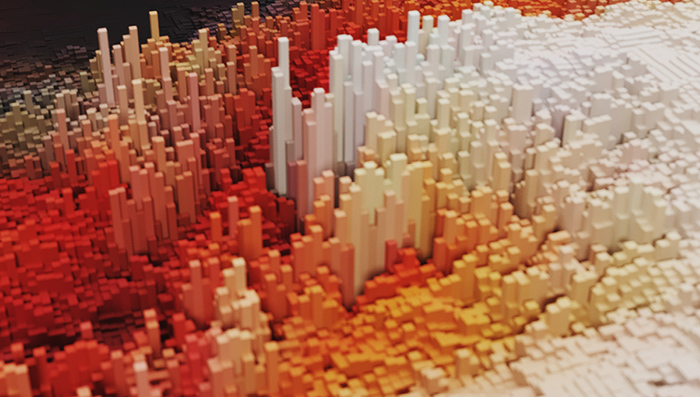
클라우드 컴퓨팅(Cloud Computing)의 급속한 확장과 공간정보(Geospatial Science)의 발달로 인해, 이 두 가지를 결합한 지오 클라우드(Geo Cloud)의 혁신이 상상 이상으로 빨라지고 있다. 클라우드 기술은 웹 기반의 서비스를 통해 관련 애플리케이션을 구동할 수 있는 인프라를 제공한다. 덕분에 기업가와 과학자, 사상가 등은 시스템이 아닌 문제 해결 자체에 집중할 수 있다. 서버의 배포나 보안 API 구축 및 확장에 대해 고민하는 시간과 비용도 줄일 수 있다. 즉 일의 추진이 한층 빨라지는 것이다. 클라우드 서비스의 대표격인 AWS(Amazon Web Services, 아마존웹서비스)가 출현한 지 어느새 14년이 흘렀지만 클라우드는 여전히 새로운 아이디어나 제품을 시장에 선보이는 가장 빠른 창구로 통한다. 
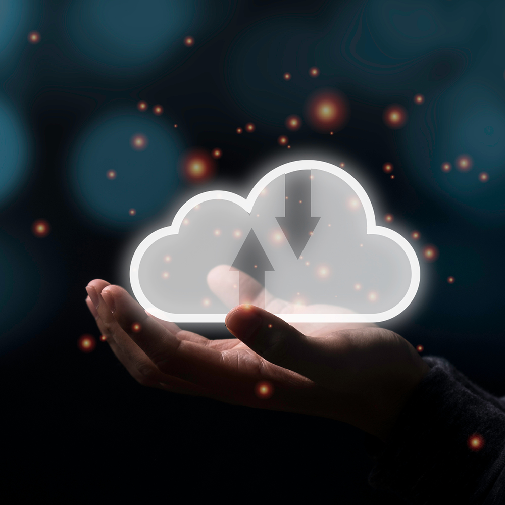
공간정보 역시 거의 모든 산업에서 발생하는 문제를 해결할 수 있는 방법을 제공한다. 공간적 관점에서 데이터를 분석해, 환경이나 사회, 경제 영역 등에서 인사이트를 도출할 수 있기 때문이다. 이렇게, 이 시대의 문제를 해결하는 두 기술이 결합한 지오 클라우드를 가능하게 하는 몇 가지 요소를 살펴보자.

With the rapid expansion of cloud computing (‘Cloud’) and the advancement of geospatial science (‘Geo’) innovation in the Geo Cloud is nearing the speed of imagination. The Cloud offers web-based services to provide the infrastructure to power applications so entrepreneurs, scientists, and thinkers can focus on the complexities of the problem they are trying to solve. Less time and money are invested in deploying servers, building secure APIs, and worrying about how to scale, which means a faster iterative process. Despite Amazon Web Services launching in March of 2006, the Cloud is the fastest way to bring a new idea or product to market. Geo provides the methodology to address a variety of challenges in almost every industry. we can analyze data from a spatial perspective that allows us to derive insights between the environmental, social, and economic landscape. let's briefly look at some of the things that make the Geo Cloud possible and one of the most important technologies of our time.

공간정보

공간정보는 지구상의 사람, 장소 및 관련 프로세스를 정보 기술을 이용해 이해하는 학문이다. 질병 확산 분석에서 전 세계의 토지 황폐화 상황을 매핑하는 일까지, 공간정보를 이용해 우리는 현상과 관련한 공간적 맥락을 분석할 수 있다. 데이터에 기반해 다양한 도전과제들에 대한 효과적인 솔루션을 구축할 수 있기 때문이다. 이에 따라 공간 데이터를 활용해 의사 결정을 내릴 수 있는 기술은 산업 전반에 걸쳐 크게 발전해왔다.
그중 ArcGIS Online은 쉽게 접근할 수 있는 클라우드 기반 매핑 애플리케이션이다. 쉽고 편리한 인터페이스를 통해 데이터 매쉬업(Mashup)과 온라인 맵을 생성할 수 있으며, 라이선스 가격까지 저렴해 누구나 GIS의 세계에 뛰어들 수 있게 했다. Mapbox는 현재 우리가 사용하고 있는 수많은 응용 프로그램을 지원한다. 에어비앤비에서 숙소를 찾을 때, 우버를 사용하거나 스탭챗으로 친구와 대화를 할 때 위치를 공유할 수 있게 해준다. 깔끔한 기본 지도 세트와 오픈 소스 API를 제공해 매핑 애플리케이션을 쉽게 개발할 수 있도록 돕는 것이다.
20세기에 개발된 핵심 기술 중 하나는 GPS였다. 처음에는 미군에 의해 개발되어 사용되다 1996년에 일반 대중에게 사용이 허용되었다. GPS 기술은 전 세계의 기업과 과학 연구 기관에 정확한 위치 정보에 대한 액세스를 제공함으로써, 오늘날 우리가 보는 것과 같은 지오 클라우드의 발전을 뒷받침했다. 오늘날의 클라우드 컴퓨팅 역시 이와 유사한 변화를 겪고 있다. 이전까지 자본과 기술을 보유한 조직에서만 활용하던 지리공간 리소스를 이제 거의 모든 사람이 활용할 수 있게 된 것이다.

Geospatial science

Geospatial science is the discipline that focuses on using information technology to understand people, places, and processes on earth. From analyzing the spread of disease to mapping land degradation across the world, we can analyze a phenomenon’s spatial context to make data-driven decisions and build effective solutions to challenging problems. There have been significant developments in the technology that enables the use of spatial data and decision making across industries.
ArcGIS Online is an easy to use cloud-based mapping application that allows for the mashup of data and the creation of online maps. With it’s easy to use interface and affordable licensing almost anyone can jump into the world of GIS. You’ve probably heard of Mapbox which powers some of the major applications we all use today. If you enjoy AirBnB, Uber, or Snapchat, then Mapbox is there helping you find a room, catch a ride, or share your location with friends. They have created a beautiful set of base maps and an open-source API that makes developing mapping applications easy.
One of the critical technologies developed in the 20th century was GPS. It was initially developed by the US military and only released to the public in 1996. It has underpinned the advancement of the Geo Cloud to what we see today by giving access to accurate location information to businesses and scientific organizations around the world. We’re now seeing a similar trend with cloud computing. Resources that were previously only accessible by organizations with significant financial capital and technical skill can be tapped into by almost anyone.

클라우드 컴퓨팅

전세계는 지금 클라우드 체제로의 변화를 꾀하고 있다. IT 관련 지출 중 거의 절반이 클라우드 관련 분야에서 발생했다는 IDC의 최근 보고서가 이를 증명한다. 클라우드 시스템은 기존 방식에 비해 비용면에서 효율적인 것은 물론, 믿을 수 있고 유연하고 어떤 면에서는 훨씬 안전하기까지 하다.
클라우드가 도입되기 전에는 여러 개의 서버를 구매한 후 잘 작동하도록 구성하고 관리해야 했으며, 서버 작동을 위한 별도의 코드도 개발해야 했다. 하지만 클라우드와 함께 ‘코드로서의 인프라 (Infrastructure as code)’ 개념이 등장했다. API를 이용해 브라우저 등을 통해 하드웨어를 배포할 수 있게 된 것이다. 이렇듯 서버 없는 애플리케이션, 클라우드에 기반한 데이터베이스와 같은 기술이 등장함에 따라, 서버와 관련해 개발자가 신경 써야 했던 부분이 사라졌다. 서버와 관련된 복잡한 작업은 클라우드에게 맡겨 두고 사용자는 비즈니스의 필수 요소에 집중할 수 있게 됐다. 스타트업의 경우, 무료 혹은 매우 적은 금액으로 클라우드 서비스를 이용해 회사를 운영할 수 있다. 즉 비즈니스 진입 장벽이 상당 부분 사라졌다. 클라우드 컴퓨팅이 문제 해결에 필요한 컴퓨팅 소스에 누구나 접근할 수 있게 한 것이다.

Cloud computing

The world continues its move to the Cloud. A recent IDC report found that almost half of IT spending will be on the Cloud. This deployment model is more cost-effective, reliable, flexible, and in some ways, more secure than traditional approaches.
Previously a fleet of servers would have to be bought, configured, and maintained along with developing the code to orchestrate and manage that fleet. Now there’s the concept of ‘infrastructure as code’ where hardware can be deployed from the browser or command line using APIs. Other advancements like serverless applications and cloud-native databases remove the server from the perspective of the developer. You get to focus on the essential elements of your business while someone else does the heavy lifting. With cloud providers providing cost-effective services by economies of scale startups can be run for little to no cost. This has removed a considerable barrier to entry for many people. Cloud computing has democratized access to the compute resources required to solve problems.

오픈 데이터

모든 정보 시스템과 마찬가지로 지오 클라우드 역시 데이터에 기반한다. 또한 세계 각국의 도시와 기관들은 오픈 데이터로 만드는 새로운 가치에 눈을 떴다. 모두에게 공개된 오픈 데이터는 투명성을 높이고 다양한 정보에 접근할 수 있게 함으로써 새로운 애플리케이션 개발을 촉진시켰다.
예를 들어, 샌디에이고시는 PandA(Performance and Analytics Department)에서 개발한 웹 사이트를 통해 수십 개의 데이터 레이어를 공개해 누구나 사용할 수 있게 했다. 덕분에 시민과 학생, 기업인 등은 시에서 진행 중인 각종 공사는 물론 범죄발생 위치, 하수관 위치, 도로 포장상태 등에 대한 서로의 생각을 탐색할 수 있다.
미국지질조사국(USGS)의 사례는 한층 글로벌하다. 전세계의 다중 스펙트럼 데이터를 수집하는 Landsat-8 위성을 통해 이미지를 공개하고 있기 때문이다. 신생 기업들은 주력 제품 생산에 위성 이미지를 사용하고 있으며, 과학자들은 아프리카의 기근을 예측하고 아마존의 삼림 벌채 정도를 감지하며, 중국의 사막화 현상을 모니터링한다. 인구센서스 역시 다양한 산업에 활용되는 중요한 데이터 세트다. 10년에 한번, 전국에 걸쳐 방대한 양의 데이터를 수집함으로써 인구 수는 물론 소득 수준, 고용률 등을 수집하고 공간적으로 분석해 다양한 문제의 원인을 찾아낼 수 있기 때문이다.

Open data

As with any information system data is the foundation of the Geo Cloud. Cities and organizations across the world have realized the value of making data publicly available. This increases transparency and jump starts the development of new applications by allowing access to information that used to be locked away. For example, the City of San Diego has made dozens of layers available on an easy to use website developed by their Performance and Analytics Department (PandA). Concerned citizens, entrepreneurs, and students can explore their ideas by tapping into a variety of data like pavement conditions and sewer pipe locations to work requests and crime locations.
On a more global scale, the USGS makes imagery available from the Landsat-8 satellite that collects multi-spectral data around the world. Many startups are using satellite imagery in their core offerings, and scientists use it to predict famines in Africa, detect deforestation in the Amazon, and monitor the expanding deserts in China. Census data is another critical data sets used in many industries. Every ten years, a massive project takes place that gathers a vast amount of data on a country-wide scale. Population, income level, and employment rates are collected and can be analyzed spatially to help uncover the causes of difficult problems.

오픈 소스

모든 정보 시스템과 마찬가지로 지오 클라우드 역시 데이터에 기반한다. 또한 세계 각국의 도시와 기관들은 오픈 데이터로 만드는 새로운 가치에 눈을 떴다. 모두에게 공개된 오픈 데이터는 투명성을 높이고 다양한 정보에 접근할 수 있게 함으로써 새로운 애플리케이션 개발을 촉진시켰다.
예를 들어, 샌디에이고시는 PandA(Performance and Analytics Department)에서 개발한 웹 사이트를 통해 수십 개의 데이터 레이어를 공개해 누구나 사용할 수 있게 했다. 덕분에 시민과 학생, 기업인 등은 시에서 진행 중인 각종 공사는 물론 범죄발생 위치, 하수관 위치, 도로 포장상태 등에 대한 서로의 생각을 탐색할 수 있다.
미국지질조사국(USGS)의 사례는 한층 글로벌하다. 전세계의 다중 스펙트럼 데이터를 수집하는 Landsat-8 위성을 통해 이미지를 공개하고 있기 때문이다. 신생 기업들은 주력 제품 생산에 위성 이미지를 사용하고 있으며, 과학자들은 아프리카의 기근을 예측하고 아마존의 삼림 벌채 정도를 감지하며, 중국의 사막화 현상을 모니터링한다. 인구센서스 역시 다양한 산업에 활용되는 중요한 데이터 세트다. 10년에 한번, 전국에 걸쳐 방대한 양의 데이터를 수집함으로써 인구 수는 물론 소득 수준, 고용률 등을 수집하고 공간적으로 분석해 다양한 문제의 원인을 찾아낼 수 있기 때문이다.

Open source

The open source philosophy has been a game changer. It’s been around for some time now, but its value to our lives can’t be overlooked. The old way of doing things stifled innovation since specialized applications and code could only be accessed by those that could pay. Some smart people figured out that by having a transparent code base, you could yield a better product while enabling alternative business models. Mapbox has an open source mapping API that brings people to their platform while monetizing other services like base maps and storage. These days dedicated people and volunteers build software that anyone can use (and contribute to) so that an idea can get off the ground quickly. Instead of building everything from scratch, the effort of other’s can be leveraged and help you get further than otherwise possible. Open Layers, Leaflet, Chart.js, and GDAL are just a few of the tools available for free. Lastly, one can’t talk about open philosophy in the Geo Cloud without mentioning OpenStreetMap. This was one of the original open data projects and preceded Google Maps and is comparable in terms of data quality. Thousands of organizations use OSM as a critical input into their operations. With over 2 million users making updates around the world, Open Street Map is up-to-date and accurate.

커뮤니티

우리 모두가 경험했듯, 인터넷에는 장단점이 있다. 하지만 한 가지 확실한 것은 정보 확산에 있어서는 인터넷이 가장 탁월하다는 점이다. 웹 사이트와 블로그 서비스를 통해 우리는 각자 발견한 지식을 다른 이들과 공유할 수 있고, 예전에는 몇 시간만에 알아냈던 것들을 쉽게 찾을 수 있게 됐다. 물론 문제를 해결하기 위해 구글 등에만 의존하고 싶지는 않겠지만, 인터넷을 사용하지 않으면 복잡한 문제를 해결하는 데 상상 이상의 시간을 허비할 수도 있다. 즉, 인터넷 커뮤니티는 보다 빠르게 그리고 다양한 접근 방식으로 문제 해결을 돕는 도구다.

Community

As we have all experienced the internet has its pros and cons, but when it comes to spreading information, it excels. Many websites and blogs enable people to share their discoveries and knowledge with the rest of us. Something that would have taken hours to figure out can be looked up and tested. Of course, you don’t want to rely on Google to solve your problems, but it keeps you from getting bogged down trying to solve a frustrating technical issue. This enables people to move quickly, learn alternative approaches to problems, and save some serious ‘banging my head on the wall’ time.

지오 클라우드가 왜 중요한가

향후 수십 년 동안 지오 클라우드 기술은 더 발전할 것이며, 발전해야만 한다. 급속한 도시화와 기후 변화로 인한 후유증부터 질병 퇴치에 이르기까지, 지오 클라우드는 지구촌의 다양한 문제를 이해하고 해결하는 데 도움이 될 것이다. 특히 위에서 살펴본 요소들을 통합해 사용하면 세상에 도움이 되는 솔루션을 만들 수 있다. 이러한 솔루션들은 자본과 권력이 있는 사람만을 위한 것이 아니다. 비용의 장벽을 낮추고, 인터넷 커뮤니티 등 공유 공간을 확대 한다면 수백만 명이 공간정보를 적용해 아이디어를 구체적인 솔루션으로 바꿀 수 있을 것이다. 향후 수십 년 동안 지오 클라우드가 인터넷 기술 분야에서 핵심적인 역할을 할 것으로 기대되는 이유다. 현재까지 최단 시간 내에 가치를 10억 달러로 끌어올린 회사가 다름아닌 전기 스쿠터를 찾아주는 지도 서비스를 제공한 스타트업이라는 점도 시사하는 바가 크다. 이렇게, 우리 곁에 바싹 다가온 지오 클라우드 기술은 새로운 미래를 열어가도록 도울 것이며, 그 과정에서 즐거움도 선사할 것이다.

Why it matters

Over the next few decades we can expect a lot more from the Geo Cloud-and we’ll need it. From the challenges of rapid urbanization and climate change to fighting disease outbreaks, the Geo Cloud will help us understand and solve these problems. Bringing together all the components we looked at, we can create solutions that will benefit the world, and they won’t come from only those with money and power. With financial barriers reduced, places of sharing established, and a spatial methodology to apply millions of people can turn their ideas into real-world solutions. We can expect the Geo Cloud to play an essential role in the technological landscape for decades to come. Right now, the fastest startup to reach $1 billion in valuation has a map at its core to help you find an electric scooter that makes your day a bit easier (or fun). The Geo Cloud era is here, and it will help us navigate the future and have some fun along the way.