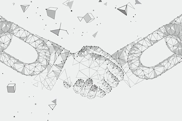
분산원장은 복제, 공유 및 동기화 되어 다양한 사이트에 보관된 디지털 기록을 일컫는데 디지털 기록이 서로 연계되고 암호로 검증되는 블록체인 역시 분산원장의 한 종류로 파악될 수 있다. OGC는 이와 같은 ‘블록체인 및 분산원장 기술’과 관련해 ‘도메인 워킹 그룹’을 만들어 해당 기술에 적용된 공간정보를 표준화 하고 그 이해를 높이고자 한다.
워킹 그룹의 목적
블록체인 및 분산원장 기술 도메인 워킹 그룹의 목적은 블록체인과 분산원장에 대한 이해를 증진하고 관련 기술에 공간정보 적용을 표준화 하는 데에 있다. 그리고 블록체인 및 분산원장 기술 도메인 워킹 그룹의 또 다른 목적은 공간정보의 표준화에 있어 부족한 부분은 무엇이고 장애물로 작용하는 이슈가 무엇인지 파악하는 것이다.Purpose of Working Group
The purpose of the BDLT DWG and its overall mission in relation to OGC processes and OGC’s business plan is to building understanding of blockchain and distributed ledger technologies, as well as the potential requirements for geospatial standardization within those technologies. Another purpose of the BDLT DWG is to identify gaps and issues that should be addressed to improve geospatial standardization in Blockchain and DLT.문제의 정의
현재 여러 개의 분산원장 서비스와 네트워크가 존재한다. 하지만 이런 분산원장에 위치를 비롯해 좌표 및 좌표참조 시스템 등의 공간정보를 인코딩하는 방법 관련 표준은 마련되어 있지 않다. 다양한 분산원장 시스템은 임시로 공간정보를 인코딩하는 방식을 사용해왔다. 그런데 지금 같은 상황이 계속되면 각기 다른 분산원장 시스템 사이의 상호 운영성이 제한될 수밖에 없다. 그리고 상호 운영성이 제한되면 데이터 교환을 위한 방법이 제한되어 사용자에게 많은 비용을 발생시키고 더 나아가 시스템 간의 낮은 상호 운영성은 정보가 소멸될 수 있는 위험성을 높인다.Problem Statement
At present, there are several DLT services and networks available. There is however no standard for how those DLT should encode geospatial information such as locations, coordinates and coordinate reference systems. The various DLT have therefore implemented ad-hoc geo encoding approaches. This situation is likely to lead to a problem of limited interoperability between information held in different DLT networks.Limited interoperability typically has the effect of higher costs for users because of limited options for data exchange. Furthermore, the risk of information loss increases when there is limited interoperability between systems.
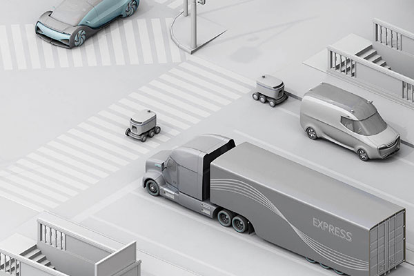
블록체인이 압도적으로 많이 사용된 산업은 금융이며, 암호화폐를 만들 때 사용되었는데 대표적으로 비트코인과 이더리움을 꼽을 수 있다. 이 비트코인과 이더리움은 블록체인의 가능성을 보여주었다. 하지만 이제는 블록체인이 금융 외에 다른 분야에서도 활용 가능성을 보여주며 인기를 얻기 시작했다. 블록체인은 암호화폐는 물론이고 토지 등록 및 법률 관련 업무에서 활용되는 것이다. 그리고 이때 공간정보는 중요한 역할을 담당한다.
쉽게 예를 들어, 블록체인을 통해 금융 거래가 어디에서 일어나는지, 어떤 세금이 부과될 수 있는지를 결정하는 것이다. 또한 토지경계 정보는 토지대장 등록의 근간이 되며, 더 나아가 어느 지역에서 범죄 관련 증거가 발견되었는지 등을 알 수 있게 해 사법 절차 진행에 있어서도 영향을 미친다.
By far, the most widely cited application of blockchain technology is in the finance sector where it can be used as a cryptocurrency as shown by Bitcoin and Ethereum.
However, other application areas are gaining popularity too, demonstrating the utility of blockchain in non-financial sectors. Blockchain has been used in a variety of applications, for example cryptocurrencies, land registration, and justice. In each of these application areas, location can play a key role.
For example, the location of transactions can determine what taxes apply, the location of the boundary of a property forms the basis of its registration, and the location where evidence is discovered in a crime scene can have an impact on judicial proceedings.
OGC는 블록체인 활용에 있어 공간정보의 중요성을 인지하고 블록체인과 분산원장 관련 검토에 착수했다. 이번 검토 작업은 지속적으로 기술 트렌드를 분석해 제공하고 현재와 미래의 동향이 OGC 표준에 어떤 영향을 미칠 수 있을지 조언하기 위해 만들어진 OGC 기술 트렌드 활동의 일환으로 진행되었다.
OGC의 블록체인과 분산원장 기술에 대한 이해를 증진시키기 위해 작성된 토론 논문은 포트 콜린스에서 열린 2018년 TC 미팅에서 채택되었다. 이 토론 논문은 아래에 열거된 공간정보 관련 분야에서 블록체인의 적용 사례를 정리했다.
- 토지 등록
- 공간
- 공공 서비스
- 정부가 관리하는 등록 서비스
- 토지 등록
- 공간
- 공공 서비스
- 정부가 관리하는 등록 서비스
Recognizing the role that location can play in applications of blockchain, the OGC initiated a review of DLT and blockchain. The review was initiated within the OGC Technology Trends activity, which has been set up to continuously provide analysis of technology trends and advise on their potential impact of current and future OGC standards.
A discussion paper (OGC 18-041r1) with the purpose of improving the OGC's understanding of blockchain and distributed ledger technologies was approved at the June 2018 TC meeting in Fort Collins.
The discussion paper has identified case studies of blockchain implementation in the following geospatial-related areas:
- Land Registration
- Space
- City Services
- Pan-Government Registries
- Land Registration
- Space
- City Services
- Pan-Government Registries
이번 토론 논문은 또한 아래 기관에서 관련 표준 제정 동향을 정리했다.
▹ 국제표준화기구
▹ 국제검사원연맹
▹ 세계은행
▹ 국제전기통신연합의 통신 부문
▹ 포텐셜 스탠다드 프럼 폼
한편, 기타 권고사항 외에 토론 논문은 도메인 워킹 그룹을 만들어 향후 블록체인을 포함한 분산원장에 적용될 수 있는 공간정보 표준화 필수사항을 정의하는 것을 돕고 ISO/TC 307 등 여타 표준화기관과 국제검사원연맹 등의 산업협회들과 연락을 유지하며 의견을 교류하고자 한다. 그리고 워킹 그룹 창립 회원들이 제시한 기타 적용 분야는 다음과 같다.
▹ 블록체인 내의 모든 개체에 대한 디지털트윈 표시
▹ 사물인터넷에서 잠재적인 분쟁을 해결할 수 있는 불변 관측의 사용
▹ 블록체인을 적용한 자산 관리
The discussion paper also identified related standardization initiatives by the following organizations:
▹ International Organization for Standardization (ISO)
▹ International Federation of Surveyors (FIG)
▹ The World Bank
▹ Telecommunications sector of the International Telecommunication Union (ITU-T)
▹ Potential Standards from FOAM
Amongst other recommendations, the discussion paper recommended the establishment of a DWG to help define future requirements for geospatial standardization of DLT (including blockchain) and maintain liaison with other standards-development organizations such as ISO/TC 307 and industry associations such as FIG.
Additional application areas that the charter members identified include:
▹ Digital Twin representations of any entity within the Blockchain
▹ The use of immutable observations in the Internet of Things (IoT) to resolve potential disputes
▹ Blockchain-supported asset management
핵심 활동
블록체인 및 분산원장 기술 워킹 그룹은 블록체인 및 분산원장 커뮤니티 내에서 공간정보 상호 운영성 관련 장애물을 해결하기 위해 설립되었다. 이 워킹 그룹은 다양한 데이터 교환 방법을 블록체인 기록의 인코딩 방식 및 구조 관련해 논의를 진행하며 공간정보를 포함한 다양한 정보가 개방된 표준에 맞춰 생성되어 블록체인과 분산원장에 사용될 수 있도록 할 것이다. 이를 위해 아래에 열거된 초기 활동을 수행한다.1. 사용 사례의 정의
2. 블록체인과 OGC 서비스 구조 및 상호 운영성에 대한 사례 연구 및 논의
3. 블록체인과 분산원장의 암호화 및 보안 영향에 대한 논의
4. 신뢰성 및 위치 검증에 대한 이슈 탐구
5. 스마트 계약서 기술 탐색
6. 표준화 관련 정의 및 OGC 표준화 베이스라인 관련 문제점 해소를 위한 워킹 그룹 구성
7. 상호 운영성 블록체인과 기타 분산원장 기술의 혜택을 볼 수 있는 공간정보 구조 정의에 도움이 되는 파일럿 및 테스트베드 추진 가능성 탐색
Key Activities
This DWG is being established to address geospatial interoperability challenges within the blockchain and wider DLT communities. The group will facilitate discussion of the requirements that define different exchange methods, encodings in blockchain records and architectures to ensure that location-referenced information that is based on open standards can also be used within blockchain and other DLT. Initial activities will include:1. Identify and define use cases
2. Discuss case studies for Blockchain and OGC Service Architecture interoperability
3. Discuss encryption and security implications of Blockchain and other DLT
4. Explore issues of Trust and Proof-of-Location
5. Explore Smart Contracts technology
6. Define any areas for standardization and create necessary Standards Working Groups to address the gaps in the OGC standards baseline.
7. Explore the potential for an interoperability pilots and testbeds that help define geospatial architectures that benefit from Blockchain and other DLT.

